By Audrey B. Capone
Copyright © 1985 Audrey B. Capone
Annandale is unique in that its history can be traced directly to the pre-Revolutionary period, when, in 1685, an Englishman by the name of Col. William H. Fitzhugh purchased over 24,000 acres of land and his descendants later named the tract "Ravensworth." From an untamed wilderness, Fitzhugh converted the land into one of the largest tobacco plantations in Northern Virginia.
For over six generations, members of the Fitzhugh family farmed at Ravensworth, slowly selling off portions of the land. It was not until 1830 that the plantation name was no longer used. In its place the community was named Annandale, after the Scottish village located at the mouth of the Annan River.
Fitzhugh's Ravensworth
Beginning in 1650, the Virginia government at Jamestown granted large parcels of land to homesteaders and speculators in Northern Virginia. William Fitzhugh, son of an English middle class woolen draper, purchased what he believed to be 21,996 acres of land from John Matthews, an original Jamestown grantee. Matthews and Fitzhugh both believed the stated acreage to be accurate, and it was not until later that Fitzhugh discovered the discrepancy in his favor.
The first recorded mention of Ravensworth was as follows: "to a white oak where Ravensworth and West, Harrison and Pearson join near the back lick." The "back lick" in this property description is a reference to Backlick Run, which travels throughout the property; West, Harrison and Pearson were Colonial landowners whose land bordered the Ravensworth tract.
Ravensworth was the largest single parcel of land granted in Northern Virginia. It was shaped like an axe, with the handle located on the southern end and the blade pointing west. Its shape was no mere coincidence. The land had been surveyed to include easy access to the Accotink drainage basin via a road bed that would later become Backlick Road. Because inland property was only valuable if crops could be easily transported to a waterway, Ravensworth was shaped in a manner that was highly valuable to its owner. It indicates that Samuel Wye, the Stafford County surveyor who mapped the property, had an educated knowledge of waterways in the area, and that he realized that tobacco, the most common commodity in seventeenth-century Virginia, had to be packed in heavy hogshead casks and "rolled" to the waterways.
There is evidence that Fitzhugh advertised some of his property for sale or lease on at least two occasions. In one piece of correspondence, he mentions that he had "convenient and good Land enough to seat 140 to 200 fam'lys upon one Dividend wch [sic] contains 21,996 acres, which I will either sell them in fee at 17 [pounds] sterling for every hundred acres, or else lease it to them for three lives paying 20 shillings p. annum for every hundred acres... "
As early as 1686, Fitzhugh mentions his property as "my Plantation," thereby indicating cultivation of the land very soon after he purchased the tract. But one of the stated requirements for taking firm title to a Colonial land patent was that the landholder had to "seat and plant" on his land within a three-year period, and that the land had to be inhabited. Rarely did holders of large tracts personally tend to the land, and Fitzhugh was no exception. He was responsible for bringing some of the first African slaves to Ravensworth and hired overseers to manage the workers and to live on the property.
Among those who leased property from Fitzhugh were French Huguenots, who had fled their native land to avoid religious persecution. But these early pioneers found living conditions at Ravensworth very primitive. Housing consisted of little more than wooden huts, and the threat of attack by unfriendly Indians, combined with the presence of wild buffalo, bands of wolves and other wild animals, put their lives in jeopardy. Some tenants left the land to journey to more heavily populated areas, usually near the waterways.
Col. Fitzhugh never lived at Ravensworth. Shortly after arriving in America, he married and built a beautiful home he called "Eagles Nest" in King George County. He resided there until his death in 1701.
At the time of his death, Fitzhugh had amassed a fortune -- partly due to the success of his plantation, but also due to a lucrative legal practice and the acquisition of other property in Northern Virginia. He was an attorney educated in England and distinguished himself as a member of the Stafford County Court and as commander of the Stafford County militia. At the time of his death he owned some 54,000 acres of land.
Fitzhugh's Successors
Upon the death of Col. William H. Fitzhugh, the Ravensworth plantation was left to his two eldest sons, William, Jr. and Henry. William, Jr. inherited the southern portion of the estate, and Henry inherited the northern portion -- which included all of the land that is now Annandale.
The southern half of Ravensworth Plantation ultimately came to rest with the children of Mary Randolph Custis Lee -- wife of the Confederate general -- who was the niece of William Fitzhugh, III. As late as 1915, Col. Bob Lee lived in the mansion called "Ravensworth," but much of the acreage in the southern half of the plantation had been sold to others.,
The northern half of the plantation came to rest with Anna Maria Battaile Fitzhugh and her five sons. When the sons became of age, the land was again divided.
The Ravensworth Mansions:
Oak Hill, Ossian Hall and Ravensworth
Three great homes were built at Ravensworth during the eighteenth century, one of which still stands as a monument to the past.
In 1779, Major Henry Fitzhugh built "Oak Hill" for his land agent, Lund Washington. At the time of construction, the home consisted of only four huge rooms, two on each floor. It was not until 1936 that the home was refurbished and expanded to resemble another of the Ravensworth mansions, "Ossian Hall." Oak Hill, the oldest of the three great homes, stands majestically on a plot of land of approximately four acres. It is privately owned and is located off Wakefield Chapel Road, hidden by trees on every side.
It is believed that Nicholas Fitzhugh, son of Major Henry Fitzhugh, built the second Ravensworth mansion, Ossian Hall, as early as 1783. There is a tradition that Ossian Hall was built in 1730, but no Fitzhughs lived on the property at that time -- the site where it was built was leased to Daniel and William Talbot until long after that date. Further, Ossian Hall was built with a large family in mind, and Nicholas had over twelve children. He was the first Fitzhugh to live on the property.
Ossian Hall faced Braddock Road where Royston Street and Rosslyn Road now intersect. The beautiful home, which resembled Mount Vernon, was visited by many notable persons during Colonial days, including George Mason, George Washington and the Marquis de Lafayette.
On September 3, 1959, Ossian Hall was burned to the ground by the Annandale Fire Department to make way for the Bristow subdivision.
"Ravensworth," the third Ravensworth mansion, was built in 1796 by William Fitzhugh of Chatham. After the death of Anna Maria Fitzhugh, the family of Robert E. Lee used the mansion as a summer home. When Mrs. Lee fled Arlington House during the Civil War, she stayed at Ravensworth briefly, but fearing that Union troops might harm the lovely old home, she journeyed further south. She need not have worried, because the three Ravensworth mansions were officially protected from harm by orders from the leaders of both sides.
Ravensworth was located slightly southeast of the intersection of Braddock Road and the Capital Beltway. The mansion was mysteriously burned in 1925.
Green Spring Farm
In addition to the Ravensworth mansions, another beautiful home was built by John Moss during the eighteenth century. Moss, a gentleman freeholder and a leader of the Methodist Church, built "Green Spring Farm" in 1760. Characteristic of the time, Moss worked the land and built the home prior to purchasing the land in 1770.
Moss was the first in the area to turn away from tobacco in favor of dairy, grain and vegetable farming. He distinguished himself as a justice of the Fairfax County Court and served the Crown as Commissioner of the King's Revenue in Fairfax. He was a captain during the American Revolution and took an active part in organizing the new government.
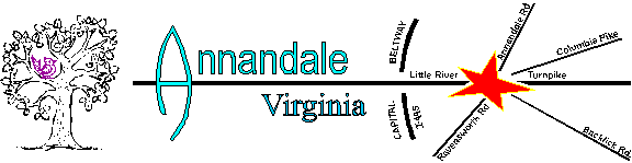
Green Spring Farm is located east of the business district off Little River Turnpike.
The Beginning of Commerce
The very first businessman to locate in Annandale was William Garges, a Mennonite from Doylestown, Pennsylvania. Garges, of German descent, purchased land that included the triangle where Columbia Pike, Little River Turnpike and Backlick Road now join in the center of town. On this land, he placed a blacksmith shop and a livery stable. He also ran the first steam driven saw mill in Fairfax County, located on the bank of the Indian Run at Little River Turnpike. The 1850 census listed two persons from the Garges family engaged in farming and three in manufacturing.
Garges became Annandale's first postmaster in 1837. Post office documents state that "Annandale Post Office was opened for business on 27 December 1837, with William Garges as Postmaster," Documents do not state where the post office was located, but Garges served in this post until his death in 1855.
The Early Community
In 1806, the Little River Turnpike was completed through Annandale, thereby connecting Annandale with Alexandria and Fairfax. Very shortly after, it was extended to Aldie. Little River Turnpike was the third toll road constructed in the nation. Toll houses were placed at intervals along the long turnpike, one of which was situated where Little River Turnpike intersects with Ravensworth Road. On Thursday, May 23, 1861, this small, log toll booth was used as a voting place for local residents to vote in the matter of Virginia's proposal to secede from the Union. Thirty-three votes were cast; twenty-nine votes for secession.
In 1808, another roadway was built which joined the Little River Turnpike in Annandale. It was named Columbia Pike. Local residents now had at least seven roads on which to travel.
By 1830, the plantation lords were gone. The land had been sectioned and sold to farmers, many of whom had come from the north with a fervor to succeed in farming, and unlike their southern neighbors, without the use of slaves
Skilled and industrious, the northerners brought with them new ways of cultivating and fertilizing crops. They also introduced a new farming technique called crop rotation, which restored the soil and resulted in healthier crops.
Gradually this new breed of farmer gave a fresh vitality to the sleepy community. Plain, but well built farmhouses dotted the countryside. Church meetings began to be held in homes. Picnics and socials followed the Sunday services. More businesses opened near the Garges enterprises, and at least two taverns opened on the outskirts of the community.
On October 1, 1846, William Garges conveyed a small piece of land for the construction of the first church, and the Annandale Methodist Chapel was built. During the Civil War, Union troops camped on the church grounds. As they left town, they burned the small church to the ground. Following the war, another church building was built slightly north of the original site. The church now stands across from where Columbia Pike and Gallows Road meet.
On June 10, 1973, at the dedication service of the Annandale Chapel Historical Marker, Rev. Raymond Fitzhugh Wrenn spoke of the history of Annandale:
"Because this area, so intimately connected with the settlement of this continent, the establishment of the Republic, and its tragic testing in Civil War, has now become an integral part of its metropolitan, growing population, in intensity of affairs, and in the extravagances of wealth, most people have little time to notice or appreciate the past except as it is most vividly portrayed before their speeding gaze."
Audrey B. Capone is a past president of the Annandale Chamber of Commerce and is vice president of Capone Music Company in Annandale, in addition to being a freelance writer. She is currently writing a book entitled, Fitzhugh's Ravenworth: The Early History of Annandale Virginia. The work will culminate her eleven years of research on the history of Annandale.
By Tom Ruzic
There’s a Kmart near the intersection of John Marr Drive and Little
River Turnpike. I find myself looking at it several mornings a week, when I catch the
light there on my way to work. I just recently learned who the street is named for.
It turns out Capt. John Quincy Marr, CSA, was the first confederate officer killed in
battle during the War Between the States. An 1846 graduate of VMI, he was a lawyer and
sheriff from Warrenton. Leader of the Warrenton Rifles, he died early on the morning of
June 1st, 1861 in a skirmish at the Fairfax Courthouse. The skirmish occurred when the
Army of the Potomac moved out of Washington, DC, on its way to what would become the
Battle of First Manassas. There’s a monument to him near the intersection of Main
Street and Chain Bridge Road, and his grave is in the Warrenton Cemetery in Fauquier
County.
There were many Federal and Confederate encampments in the Annandale area throughout the
war – as we’re located on what was a shifting “no man’s land”
that made up the defensive perimeter of Washington. There might have been tents in your
own backyard.
Of course, that was long before there was a John Marr Drive. Or a Kmart.
![]()
![]()